
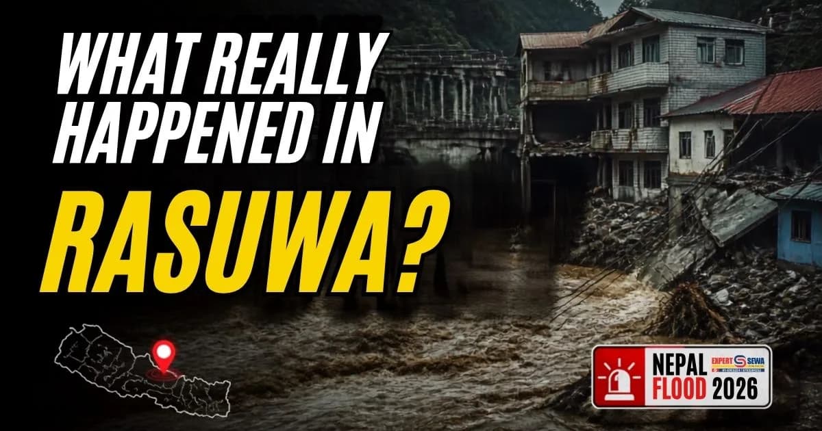
What Really Happened in Rasuwa? The 2026 Nepal Flood Explained
This article is based on the latest verified information available at the time of publication. Casualty, missing-person, and damage figures may change as search, identification, and assessment operations continue.
The Rasuwa flood 2026 was not an ordinary monsoon event; it was a sudden, catastrophic debris flow that permanently reshaped Himalayan valleys in a matter of minutes. On the morning of August 26, 2026, a massive surge of water, ice, mud, and boulders tore through the Lhende Khola and Bhote Koshi river systems, devastating the Nepal-China border region before cascading deep into central Nepal1.
For those asking what happened in Rasuwa, the disaster highlights the rapidly evolving, year-round hazards of the high mountains. Sweeping away entire settlements, international trade hubs, and critical infrastructure, the event overwhelmed early-warning systems designed for gradual river swelling rather than rapid glacial surges1. This report meticulously details the origins of the Nepal flood 2026, the scale of the destruction, the complex rescue efforts, and the urgent scientific investigations underway to understand this unprecedented mountain disaster.
What Happened in Rasuwa?
At approximately 8:40 AM local time on August 26, 2026, an immense volume of debris and water entered Nepal through the Lhende Khola-Bhote Koshi river system near the Rasuwagadhi border crossing1. Traveling downstream at terrifying speeds of up to 75 kilometers per hour, the floodwater ripped through narrow Himalayan corridors, carrying heavy sediment and boulders that acted as battering rams against anything in their path1.
The sudden nature of the flood left communities entirely vulnerable. The surge struck shortly before 9:00 AM, precisely as children were walking to school and the border trade corridors were bustling with daily activity4. The violent flow merged into the Trishuli River, sending a wall of water downstream across multiple districts. Hydrological monitoring stations recorded extraordinary anomalies; at Galchhi, roughly 50 kilometers downstream from the source, the Trishuli River reportedly rose by approximately nine meters in just 30 minutes1. The sheer velocity and volume of the Rasuwa flash flood swept away upstream automatic flood-monitoring stations before they could transmit adequate warnings to the vulnerable populations below1.
What Caused the Rasuwa Flood?
The precipitating mechanism behind the disaster remains the subject of intense scientific investigation, though strong consensus points to a high-altitude cryosphere event rather than a rainfall-induced flood. Early reports from Nepal's government and the United States Geological Survey (USGS) suggested a magnitude 4.4 earthquake had triggered an avalanche7. However, after analyzing seismic waves and satellite imagery, the USGS and independent glaciologists heavily revised these preliminary findings.
Investigators confirmed that no tectonic earthquake had occurred. Instead, the leading scientific explanation indicates a massive glacier collapse near the Langtang Lirung and Tsangbu Ri peaks generated a violent impact, creating shockwaves equivalent to a magnitude 5.2 seismic event1. Geomorphologists hypothesize that the collapsed mass of ice and rock fell thousands of feet, with the intense friction and velocity causing rapid melting upon impact2.
When this massive debris load entered the river valley, it likely formed a temporary dam, blocking the Lhende Khola. The rapid, catastrophic breach of this landslide dam released a sudden surge of meltwater, rock, and mud4. This specific mechanism a glacier collapse and debris flow—differs from a traditional Glacial Lake Outburst Flood (GLOF), as the primary water source was immediate kinetic melting and river displacement rather than a pre-existing glacial lake7.
How the Flood Became So Destructive
The severity of the Rasuwa flood disaster was heavily compounded by Nepal's unique topographical vulnerabilities. The steep Himalayan gradient paired with deep, narrow river gorges acts as a natural funnel, accelerating the water's speed and multiplying its destructive kinetic force7.
As the surge traveled, it aggressively scoured the riverbanks, accumulating thousands of tons of mud, rocks, and uprooted trees. This transition from a simple water flood to a hyper-concentrated debris flow allowed the surge to effortlessly demolish reinforced concrete infrastructure3. Furthermore, habitable land in these narrow valleys is highly limited. Consequently, local populations, trekking routes, and hydropower facilities are clustered directly along the riverbanks, sitting squarely in the flood's path7. With early-warning stations destroyed and communication networks instantly severed, the downstream populations had virtually no warning time to reach higher ground, exacerbating the loss of life1.
Which Areas Were Affected?
The devastation spanned a roughly 72-kilometer stretch, severely impacting three primary districts—Rasuwa, Nuwakot, and Dhading—with downstream alerts reaching Gorkha, Tanahun, Nawalparasi, and Chitwan1. The sheer force of the current carried debris, and tragically victims, more than 240 kilometers away, with bodies recovered as far downstream as neighboring India's Uttar Pradesh state2.
Affected Region | Verified Impacts and Destruction |
Rasuwa (Border Area) | Timure bazaar and the Rasuwagadhi customs checkpoints were entirely swept away. Syabrubesi, a critical gateway for the Langtang trekking route, suffered extensive structural damage. Gyirong Port on the Chinese side was completely destroyed1. |
Nuwakot and Dhading | Settlements along the Trishuli River corridor, including Mailung, Betrawati, Trishuli Bazaar, and Devighat, experienced massive inundation. Agricultural lands were buried under mud, and several key concrete bridges were obliterated1. |
Downstream Districts | Gorkha, Tanahun, Nawalparasi, and Chitwan experienced elevated water levels, prompting widespread evacuation orders along the Narayani and Gandak river basins7. |
Human Impact of the Rasuwa Flood
The human toll of the disaster has been catastrophic and geographically widespread. The figures reflect verified reports from the Nepal Police and the National Disaster Risk Reduction and Management Authority (NDRRMA) as of August 29, 2026. Authorities confirmed 2,301 individuals were injured and successfully rescued, with 140 treated and discharged from hospitals in the Kathmandu Valley8. Displaced families face severe humanitarian concerns; one previously resettled community of 250 households, recovering from the 2015 earthquake, was entirely erased by the floodwaters4.
Casualty Category | Verified Figures (As of August 29, 2026) |
Confirmed Deaths (Nepal) | At least 669 bodies recovered across affected districts (Chitwan: 248, Nawalparasi: 233, Gorkha: 54, Dhading: 49, Nuwakot: 41, Tanahun: 31, Rasuwa: 13)8. |
Missing Persons (Nepal) | Over 2,426 individuals reported missing, heavily concentrated in the Rasuwa and Nuwakot districts2. |
Foreign Nationals | 589 foreign nationals remain missing, including 288 Indian pilgrims on the Mount Kailash route, 90 Americans, 51 Malaysians, 35 Australians, and 33 UK nationals2. |
Security and Workers | 85 security personnel (Nepal Army, Police, APF), 60 hydropower workers, 26 bank staff, and 15 customs officers are among the missing5. |
Tibet Autonomous Region | Chinese authorities reported 7 confirmed deaths and 554 missing, including 260 foreign nationals at the Gyirong Port2. |
Damage to Roads, Bridges, Hydropower and Infrastructure
The flood crippled the region's economic and physical infrastructure, halting international trade, domestic energy production, and regional mobility. The destruction of regional telecom towers severely hampered crisis communication, turning the emergency response into a logistical nightmare5.
Infrastructure Sector | Extent of Damage |
Roads and Highways | The entire 42-kilometer highway linking Betrawati to the Rasuwagadhi border crossing was completely destroyed, severing the primary overland trade route between Kathmandu and Tibet4. |
Bridges | The Department of Roads confirmed the loss of at least 35 motorable concrete bridges and 45 suspension bridges11. |
Hydropower Projects | 14 operational and under-construction hydropower and solar projects were heavily damaged, knocking approximately 748 megawatts of capacity offline3. |
Public and Border Facilities | Nine commercial bank branches, the Timure customs office, multiple schools, health facilities, weather stations, and the Gyirong Port trade hub were swept away2. |
Why Was Rescue So Difficult?
Mounting a swift rescue operation proved extraordinarily difficult due to the obliteration of access points. The total destruction of the primary highway meant ground troops and heavy machinery could not reach the hardest-hit zones in Rasuwa3.
Initially, rescue helicopters struggled to land because of the highly unstable terrain, heavy debris fields, and turbulent weather inside the narrow mountain gorges7. The lack of communication infrastructure meant that many remote communities were cut off from calling for help or receiving evacuation coordinates4. Furthermore, rescue workers faced the constant threat of secondary hazards, including unstable slopes and further mudslides, forcing operations to pause repeatedly to protect emergency personnel2.
The Risk of Secondary Flooding and Dammed Lakes
A pressing concern in the immediate aftermath was the formation of barrier lakes—temporary dams created by rock and ice blocking the river's natural flow upstream. Satellite imagery provided by the International Charter "Space and Major Disasters" confirmed the formation of at least two barrier lakes1.
On August 27, Chinese authorities issued urgent warnings regarding a barrier lake with an estimated volume of 2 million cubic meters near the confluence of the Chhochen Khola and Purepu Tsangpo rivers2. The lake briefly overflowed on August 28, prompting immediate evacuation orders for Jilong port and causing a temporary halt to rescue operations due to the high potential of a secondary breach2. Authorities and scientists from the International Centre for Integrated Mountain Development (ICIMOD) continuously monitored the blockages, ensuring downstream communities remained on high alert while evaluating the stability of the natural dams6.
What Scientists Say About the Disaster
Scientists approach the attribution of this disaster with necessary caution. While investigators have identified the 5.2 magnitude-equivalent glacier collapse as the physical mechanism, linking this specific, localized event directly to broad climate change requires extensive, long-term data analysis2.
However, glaciologists and climate researchers note that the disaster clearly aligns with the rapidly changing dynamics of the Himalayan cryosphere. Rising global temperatures are accelerating glacier retreat, thawing permafrost, and destabilizing high-altitude ice and rock walls6. Experts warn that the Lhende Khola valley, which experienced a similar but smaller destructive flood in July 2025, is exhibiting signs of chronic geological instability1. Scientists emphasize that the risk profile for downstream communities is changing dramatically, transitioning from seasonal monsoon threats to unpredictable, year-round cryosphere hazards3.
Nepal's Rescue, Relief and Recovery Response
In response to the unprecedented disaster, the Government of Nepal mobilized over 4,800 personnel from the Nepal Army, Armed Police Force, and Nepal Police on a war footing5. Despite the logistical hurdles, air-rescue operations successfully evacuated hundreds of stranded tourists and injured locals from Timure and Syabrubesi11.
Medical teams, including doctors from the National Trauma Center and Bir Hospital, were airlifted to temporary triage centers to stabilize the injured11. Humanitarian agencies, including the International Organization for Migration (IOM), CARE Nepal, and the International Federation of Red Cross and Red Crescent Societies (IFRC), quickly deployed rapid-response kits containing solar panels, water purification supplies, and temporary shelters4. The NDRRMA estimated that over 10,000 households required immediate emergency relief, prompting international appeals for aid to address the shelter, food, and medical crises12.
What Does the Rasuwa Flood Mean for Nepal's Future?
The Rasuwa flood 2026 exposed fatal limitations in existing Early Warning Systems (EWS). These systems were largely calibrated for slow-rising monsoon waters rather than high-velocity, sediment-laden debris flows triggered by sudden glacier collapses2.
Moving forward, disaster risk reduction in Nepal must pivot toward comprehensive high-altitude monitoring. This requires deploying remote sensing technology for glacier stability, enforcing stricter construction zoning away from vulnerable riverbanks, and building infrastructure capable of withstanding extreme kinetic impacts. Crucially, as the disaster crossed international boundaries, the event underscored the urgent necessity for robust, real-time, cross-border disaster coordination and data sharing between Nepal and China to protect downstream populations6.
Timeline of the 2026 Rasuwa Disaster
Date | Event Details |
July 2025 | A smaller flood strikes Rasuwa, highlighting the growing instability of the Lhende Khola corridor1. |
August 26, 2026 (08:40 AM) | A massive glacier collapse occurs near Langtang Lirung, registering as a 5.2 magnitude seismic event. Debris enters the river system3. |
August 26, 2026 (~09:00 AM) | The flood surge crosses the border, destroying Timure and Gyirong Port before advancing rapidly down the Trishuli River4. |
August 27, 2026 | Initial air rescues commence. Satellite imagery confirms the formation of dangerous upstream barrier lakes, halting some ground operations1. |
August 28, 2026 | A 2-million-cubic-meter barrier lake briefly overflows; downstream evacuation alerts are heightened, and rescue operations temporarily pause2. |
August 29, 2026 | Authorities confirm 669 bodies recovered across multiple districts as search operations expand into downstream regions in Nepal and India8. |
Frequently Asked Questions
What happened in Rasuwa in 2026?
On August 26, 2026, a massive, fast-moving flash flood of water, rock, and mud tore through the Lhende Khola and Trishuli River valleys in Nepal's Rasuwa district. The surge destroyed border ports, 42 kilometers of major highways, dozens of bridges, and numerous settlements, resulting in hundreds of fatalities and thousands of missing persons.
What caused the Rasuwa flood?
Scientific investigations indicate the flood was triggered by a massive glacier collapse and rock collapse high in the Himalayas. The collapsing ice generated a 5.2 magnitude-equivalent seismic signal. The debris fell into the river valley, causing a rapid displacement of water and a hyper-concentrated debris flow.
Was the Rasuwa flood caused by a glacier collapse?
Yes. While initially misreported as an earthquake-induced avalanche, the USGS and international glaciologists confirmed that a massive high-altitude glacier collapse and subsequent debris flow was the primary physical mechanism that initiated the disaster.
Which rivers were affected by the Rasuwa flood?
The disaster originated in the Lhende Khola, a tributary that feeds into the Bhote Koshi River. The surge then cascaded aggressively into the Trishuli River, sending floodwaters and debris far downstream into the Narayani and Gandak river systems in India.
How many people were affected by the Rasuwa flood?
The human impact has been devastating. As of August 29, 2026, authorities had recovered 669 bodies and rescued over 2,300 injured individuals. Over 2,400 people remain missing, including hundreds of foreign tourists, hydropower workers, and local residents.
Which districts were affected?
The most severe destruction occurred in the Rasuwa, Nuwakot, and Dhading districts of Nepal, as well as Gyirong County on the Tibetan side of the border. Downstream impacts and body recoveries extended into Gorkha, Tanahun, Nawalparasi, Chitwan, and Uttar Pradesh, India.
What damage did the Rasuwa flood cause?
The flood caused unparalleled infrastructure damage. It completely wiped out the 42-kilometer highway linking Nuwakot to Tibet, destroyed over 35 motorable bridges, devastated the Gyirong and Timure customs ports, and severely damaged 14 hydropower projects totaling 748 megawatts of capacity.
Is Rasuwa at risk of another flood?
Yes. Following the initial disaster, authorities identified temporary barrier lakes formed by debris blockages in the upper river system. While closely monitored, the unstable mountain geography and changing climate keep the region at a high risk for secondary flooding.
Conclusion
Understanding the Rasuwa flood 2026 requires looking beyond the immediate images of destruction and examining the complex interplay of Himalayan geography, rapidly changing mountain hazards, and severe infrastructure vulnerability. The disaster proves that traditional disaster preparedness, focused on seasonal monsoon rains, is inadequate against sudden, high-velocity cryosphere events like glacier collapses. As Nepal recovers from the loss of life, trade routes, and hydropower capacity, the focus must shift toward resilient infrastructure planning, advanced glacier monitoring, and establishing highly reliable, cross-border early-warning systems. Only through proactive adaptation can mountain communities hope to survive the evolving geological realities of the high Himalayas.
Sources and Further Reading
Government of Nepal, National Disaster Risk Reduction and Management Authority (NDRRMA) – Situation Reports and Updates
International Centre for Integrated Mountain Development (ICIMOD) – Major flash flood sweeps through Nepal's Rasuwa district (August 26, 2026) https://www.icimod.org/press-release/major-flash-flood-sweeps-through-nepals-rasuwa-district-raising-fears-of-further-downstream-flooding/
ReliefWeb / UN OCHA – Nepal flash floods: Rapid situation overview (August 27, 2026) https://reliefweb.int/report/nepal/nepal-flash-floods-rapid-situation-overview-27-august-2026
CARE International – Nepal flash floods 2026: CARE's emergency response (August 28, 2026) https://www.care.org/news-and-stories/nepal-flash-floods-2026-care-emergency-response/
International Organization for Migration (IOM) – Nepal Flood Response Situation Report #1 (August 27, 2026) https://asiapacific.iom.int/resources/iom-nepal-flood-response-situation-report-1
Works cited
1. August 2026 Nepal Trishuli Flood, https://storymaps.arcgis.com/stories/f2b2425eac544929a7d18f4c90b41d66
2. 2026 Nepal floods - Wikipedia, https://en.wikipedia.org/wiki/2026_Nepal_floods
3. The deadly forces behind Nepal’s Himalayan disasters, https://timesofindia.indiatimes.com/world/south-asia/the-deadly-forces-behind-nepals-himalayan-disasters/articleshow/133614019.cms
4. Nepal flash floods 2026: CARE's emergency response, https://www.care.org/news-and-stories/nepal-flash-floods-2026-care-emergency-response/
5. Nepal Flash Floods: Rapid Situation Overview (27 August 2026), https://reliefweb.int/report/nepal/nepal-flash-floods-rapid-situation-overview-27-august-2026
6. Major flash flood sweeps through Nepal's Rasuwa district ... - ICIMOD, https://www.icimod.org/press-release/major-flash-flood-sweeps-through-nepals-rasuwa-district-raising-fears-of-further-downstream-flooding/
7. Nepal flash floods explained: What triggered them and key FAQs answered, https://timesofindia.indiatimes.com/education/news/nepal-flash-floods-explained-what-triggered-them-and-key-faqs-answered/articleshow/133567849.cms
8. Latest update: 669 bodies recovered in Rasuwa Bhote Koshi flood, https://english.nepalnews.com/s/nation/latest-update-669-bodies-recovered-in-rasuwa-bhote-koshi-flood/
9. Rasuwa Flood Update: Is the Langtang Trek Route Safe 2026?, https://www.greenvalleynepaltreks.com/travel-guides/bhotekoshi-flood-in-rasuwa
10. Nepal: Deadly Flash Floods - August 26, 2026, No. 1, https://reliefweb.int/report/nepal/nepal-deadly-flash-floods-august-26-2026-no-1
11. Nepal Floods: Death toll rises to 165, hundreds still missing, https://www.aninews.in/news/world/asia/nepal-floods-death-toll-rises-to-165-hundreds-still-missing20260827102252
12. Nepal Flood Response Situation Report #1 | 27 August 2026, https://reliefweb.int/report/nepal/nepal-flood-response-situation-report-1-27-august-2026
13. IOM Nepal Flood SitRep, https://asiapacific.iom.int/resources/iom-nepal-flood-response-situation-report-1